How to Use Ratios for Scale Drawings and Maps: Complete Guide
Learn how to use ratios for scale drawings and maps. Convert map distances to real ground measurements, calculate scale factors, and master unit conversions.
Scale drawings and maps represent real world buildings, landscapes, and geographical distances in a compact, portable format. Whether you are studying an architectural blueprint, navigating a hiking trail with a topographic map, or building a model airplane, the bridge between paper size and reality is governed by ratios.
A scale ratio expresses the proportional relationship between a measured distance on a drawing and the actual distance on the ground.
In cartography and technical drawing, this ratio is written as 1 : n, where 1 unit on the drawing represents n of the exact same units in real life.
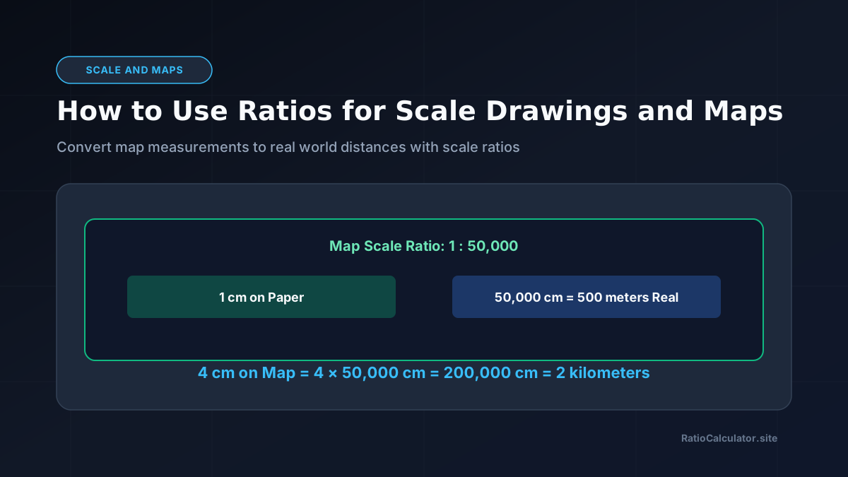
For example, on a map with a scale ratio of 1 : 50,000, exactly 1 centimeter on the paper represents 50,000 centimeters on the ground. Converting 50,000 centimeters to meters (divide by 100) and kilometers (divide by 1,000) shows that 1 centimeter on the map equals 500 meters, or 0.5 kilometers in reality.
To calculate scale factors, convert dimensions between physical models and real objects, or verify scale blueprints, explore our dedicated Scale Factor Calculator.
Interactive Map & Scale Distance Converter
Live ToolEnter a paper measurement and map scale ratio to calculate the real ground distance in meters and kilometers:
What Is a Scale Ratio?
A scale ratio, also known as a representative fraction, is a dimensionless proportion. Because it uses identical units on both sides of the colon, the ratio holds true regardless of whether you measure in millimeters, centimeters, inches, or feet.
Scale drawings fall into two primary categories:
- Reduction drawings: The scale ratio has a larger second number (such as 1 : 100 or 1 : 25,000). The drawing is smaller than the actual object. Maps and architectural floor plans are reductions.
- Enlargement drawings: The scale ratio has a larger first number (such as 10 : 1 or 50 : 1). The drawing is larger than the actual object. Microscopic diagrams and watchmaker schematics are enlargements.
| Scale Type | Standard Ratio | 1 Unit on Drawing Equals | Common Use Case |
|---|---|---|---|
| Detailed Floor Plan | 1 : 50 | 50 cm (0.5 meters) | Interior Architecture and Rooms |
| Building Blueprint | 1 : 100 | 100 cm (1.0 meter) | Commercial Construction Plans |
| City Street Map | 1 : 10,000 | 10,000 cm (100 meters) | Urban Walking and Transit Maps |
| Topographic Hiking Map | 1 : 25,000 | 25,000 cm (250 meters) | Trail Navigation and Elevation |
| Regional Road Atlas | 1 : 100,000 | 100,000 cm (1 kilometer) | Highway Route Navigation |
Metric Unit Conversion Essentials for Maps
The primary challenge in map calculations is converting between centimeters, meters, and kilometers.
Memorize these three conversion anchors:
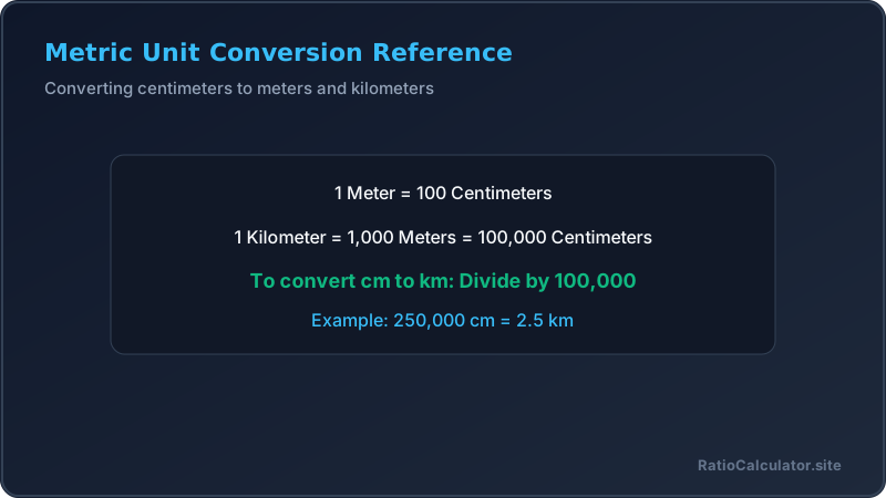
- 1 meter = 100 centimeters
- 1 kilometer = 1,000 meters
- 1 kilometer = 100,000 centimeters
To convert centimeters to kilometers, divide by 100,000 (shift the decimal point 5 places to the left). To convert kilometers to centimeters, multiply by 100,000.
Calculating Real Distance From a Map Measurement
To find actual real ground distance when measuring with a ruler on a map:
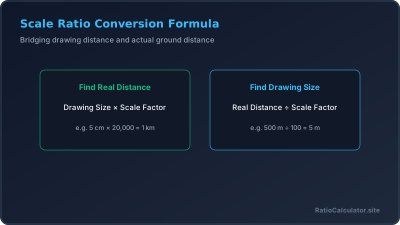
Real Distance = Measured Drawing Distance × Scale Factor
Worked Example 1: Hiking Trail Calculation
On a topographic map with a scale of 1 : 25,000, a hiking trail measures 8 centimeters between a campsite and a scenic overlook. What is the actual hiking distance in kilometers?
- Identify scale: 1 cm on map = 25,000 cm in reality.
- Measure on map: 8 cm.
- Calculate ground distance in centimeters: 8 cm × 25,000 = 200,000 cm.
- Convert centimeters to meters: 200,000 cm ÷ 100 = 2,000 meters.
- Convert meters to kilometers: 2,000 m ÷ 1,000 = 2 kilometers.
- The actual trail distance is 2 kilometers.
Calculating Drawing Size From a Real Distance
To find how long a line must be drawn on paper to represent a known ground dimension:
Drawing Distance = Real Distance ÷ Scale Factor
Worked Example 2: Architectural Living Room Plan
An architect is drafting a residential floor plan at a scale of 1 : 50. The real living room length is 6.5 meters. How long should the living room wall be drawn on the blueprint in centimeters?
- Identify scale: 1 : 50.
- Real length: 6.5 meters.
- Convert real length to centimeters: 6.5 m × 100 = 650 cm.
- Apply scale formula: 650 cm ÷ 50 = 13 cm.
- The architect must draw the living room wall exactly 13 centimeters long on the paper.
Finding the Scale of an Unknown Map or Drawing
If you know both the map measurement and the real world distance, you can deduce the map scale ratio:
Scale Ratio = Measured Drawing Distance : Real Distance (in matching units)
Worked Example 3: Deducing Map Scale
Two towns are 15 kilometers apart in reality. On an old road map, the distance between the towns measures 15 centimeters. What is the scale ratio of the map?
- Real distance: 15 km.
- Drawing distance: 15 cm.
- Convert real distance to centimeters: 15 km × 100,000 = 1,500,000 cm.
- Set up ratio with matching units: 15 cm : 1,500,000 cm.
- Simplify by dividing both terms by 15: (15 ÷ 15) : (1,500,000 ÷ 15) = 1 : 100,000.
- The map scale ratio is 1 : 100,000.
For scaling images, photography crops, and digital displays without distorting proportions, you can also explore our Aspect Ratio Calculator.
To split architectural or survey scale proportions across multiple building sections, use the Ratio Division Calculator on our site.
Common Mistakes to Avoid
- Forgetting to match units before writing a ratio: Writing a 15 cm to 15 km scale as 15 : 15 = 1 : 1 is an enormous error. You must convert 15 km to 1,500,000 cm first.
- Dividing instead of multiplying: When finding real ground distance, you must multiply by the scale factor, not divide. Real distance is always larger than drawing distance in reduction maps.
- Misplacing decimal points during metric conversion: Converting centimeters to kilometers requires dividing by 100,000 (5 zeros), not 1,000.
- Scaling area using the linear scale factor: If a floor plan scale is 1 : 50, the area scales by 50 squared (2,500), not by 50. Linear scale factors apply only to lengths.
How to Verify Your Answer
To confirm your scale calculations are correct, perform a reciprocal calculation:
- If you calculated that 8 cm at 1 : 25,000 equals 2 km, take the 2 km (200,000 cm) and divide by 25,000. It must return exactly 8 cm.
- Always apply a sanity check: if your calculated real distance between two cities turns out to be 2 meters, you clearly divided instead of multiplying.
Reference standard: Learn about topographical map scale standards from the United States Geological Survey (USGS).
Conclusion
Ratios are the essential mathematical foundation that makes maps, blueprints, and scale models possible. By understanding representative fractions, converting units systematically, and applying the simple formulas for drawing and ground distances, you can read and create scale drawings with complete precision. Verify scale ratios and model conversions anytime with our Scale Factor Calculator.
Frequently Asked Questions
What does a 1 to 50000 map scale mean?
It means that 1 unit measured on the map represents 50,000 of the same units on the ground, so 1 cm equals 500 meters.
How do you convert centimeters on a map to kilometers?
Multiply the centimeters by the scale factor to get real centimeters, then divide by 100,000 to convert to kilometers.
What is the difference between a large scale map and a small scale map?
A large scale map (like 1 : 10,000) shows a small area with high detail, while a small scale map (like 1 : 1,000,000) shows a large region with less detail.
How do you calculate real distance from a scale drawing?
Multiply the measurement taken on the drawing by the scale factor and convert to your desired real world unit.
How do you find the drawing size from a real distance?
Convert the real distance into centimeters and divide by the scale factor to find the length to draw.
Why do scale ratios have no units of measurement?
Because the ratio uses identical units on both sides, which cancel out into a pure dimensionless proportion.
Does a linear scale factor apply to area calculations?
No, area scales by the square of the linear scale factor, so a 1 to 10 length scale produces a 1 to 100 area scale.